|
|
|
Advertisements:
GeographyLocation
Southern South America, islands in the South Atlantic Ocean, east of the tip of South America Geographic coordinates
54 30 S, 37 00 W
Map references
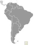
South America
Area World Ranking: 177
Total 3,903 sq km
Land 3,903 sq km Water 0 sq km Note Includes Shag Rocks, Black Rock, Clerke Rocks, South Georgia Island, Bird Island, and the South Sandwich Islands, which consist of 11 islands Area - comparative
Slightly larger than Rhode Island Land boundaries
0 km
Coastline
NA
Maritime claims
Territorial sea 12 nm
Exclusive fishing zone 200 nm Climate
Variable, with mostly westerly winds throughout the year interspersed with periods of calm; nearly all precipitation falls as snow Terrain
Most of the islands, rising steeply from the sea, are rugged and mountainous; South Georgia is largely barren and has steep, glacier-covered mountains; the South Sandwich Islands are of volcanic origin with some active volcanoes Elevation extremes
Lowest point Atlantic Ocean 0 m
Highest point Mount Paget (South Georgia) 2,934 m Natural resources
Fish
Land use
Arable land 0%
Permanent crops 0% Other 100% (largely covered by permanent ice and snow with some sparse vegetation consisting of grass, moss, and lichen) (2005) Irrigated land
0 sq km
Natural hazards
The South Sandwich Islands have prevailing weather conditions that generally make them difficult to approach by ship; they are also subject to active volcanism Environment - current issues
NA
Geography - note
The north coast of South Georgia has several large bays, which provide good anchorage; reindeer, introduced early in the 20th century, live on South Georgia
Comments
Add a new comment: |
Advertisement
Members area
South Georgia And The South Sandwich Islands [ United Kingdom ] (Overseas Territory):
 
GPS points from South Georgia And The South Sandwich Islands [ United Kingdom ] (Overseas Territory)
|
||||||||

 The islands, which have large bird and seal populations, lie approximately 1,000 km east of the Falkland Islands and have been under British administration since 1908 - except for a brief period in 1982 when Argentina occupied them. Grytviken, on South Georgia, was a 19th and early 20th century whaling station. Famed explorer Ernest SHACKLETON stopped there in 1914 en route to his ill-fated attempt to cross Antarctica on foot. He returned some 20 months later with a few companions in a small boat and arranged a successful rescue for the rest of his crew, stranded off the Antarctic Peninsula. He died in 1922 on a subsequent expedition and is buried in Grytviken. Today, the station houses scientists from the British Antarctic Survey. Recognizing the importance of preserving the marine stocks in adjacent waters, the UK, in 1993, extended the exclusive fishing zone from 12 nm to 200 nm around each island.